served from 129.236.110.25
∫dlon max [ UEA CRU TS4p0 monthly pre ] : precipitation data
∫dlon max [ UEA CRU TS4p0 monthly pre ] .Independent Variables (Grids)
- lon (longitude)
- grid: /lon (degree_east) ordered (180W) to (180) by 0.5 N= 721 pts :grid
Other Info
- bufferwordsize
- 8
- CE
- 700
- correlation_decay_distance
- 450.0
- CS
- 0
- datatype
- doublearraytype
- file_missing_value
- 9.96920997E36
- maxncolor
- 254
- missing_value
- NaN
- standard_name
- lwe_precipitation_rate
- units
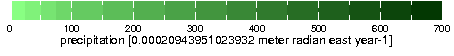
- 0.00020943951023932 meter radian east year-1
- history
- $integral dlon$ max [ UEA CRU TS4p0 monthly pre ]
- Wed 10 Jul 2013 18:28:10 BST : User ianharris : Program makegridsauto.for called by update.for
max over lat[89.75S, 89.75N] time[1200 16 Jan 1901 - 2400 14 Feb 1901, 0000 16 Nov 2015 - 1200 16 Dec 2015]
- Wed 10 Jul 2013 18:28:10 BST : User ianharris : Program makegridsauto.for called by update.for
- colorscale
References
Harris_etal2013Last updated: Wed, 17 Jan 2024 21:25:22 GMT
Data Views
| lon | |
| M |
|---|
Filters
Here are some filters that are useful for manipulating data. There are actually many more available, but they have to be entered manually. See Ingrid Function Documentation for more information.- Monthly Climatology calculates a monthly climatology by averaging over all years.
- anomalies calculates the difference between the (above) monthly climatology and the original data.
- Integrate along lon
- Differentiate along lon
- Take differences along lon
RMS (root mean square with mean *not* removed) over lon |
RMSA (root mean square with mean removed) over lon |
Maximum over lon |
Minimum over lon |
Detrend (best-fit-line) over lon |
Note on units